Impact area · Construction & safety
Construction and Safety
The construction and safety of CO₂ pipelines — and what that could mean for Whaley Bridge.
The construction and safety of CO₂ Pipelines. Potential impact on Whaley Bridge
Works
Construction of the Pipeline
In this section I will summarise what is currently known about the pipeline and its construction in the area around Whaley Bridge. At present the exact route has not yet been defined by Peak Cluster but a “Scoping Zone” has been published (See the Route section of this website). This route has recently been updated as detailed in the ROUTE section of this website.
The pipeline is designed to transport carbon dioxide (CO₂) gas at high pressure. In total it will be around 198 km long, up to 36 inch in diameter (91.4 cm) and made from high-grade carbon steel.
For specific information on the construction of the proposed Peak Cluster pipeline you should refer to the Peak Cluster Environmental Impact Assessment — this document provides detailed information relating to the construction of the pipeline in sections 3.2.67 to 3.2.93 (Pages 28 to 31) and this is essential reading for anyone who wants more detail on how the pipeline will be constructed. The Peak Cluster factsheet also provides more information.
The details of the Peak Cluster pipeline route and engineering design are not yet finalised. The following section provides an overview of issues that may arise from the building of any large high pressure CO₂ pipeline constructed using “Open Trench” methods in the landscape around Whaley Bridge and is not specific to the Peak Cluster Project.
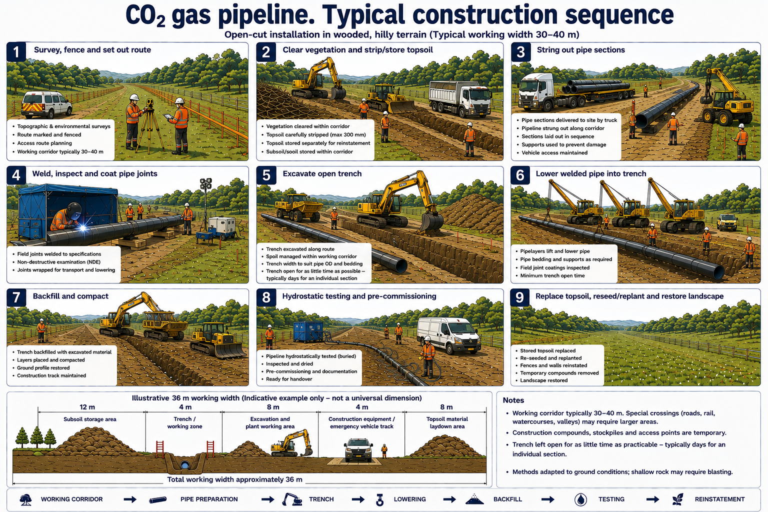
The graphic below gives a general overview of a typical gas pipeline open trench installation Construction Sequence.
Illustrations and written descriptions of the pipeline laying process can make this seem like a fairly benign construction technique. To show what pipeline construction sites can look like in reality, consider the images below. All these photos were taken on UK pipeline construction sites.
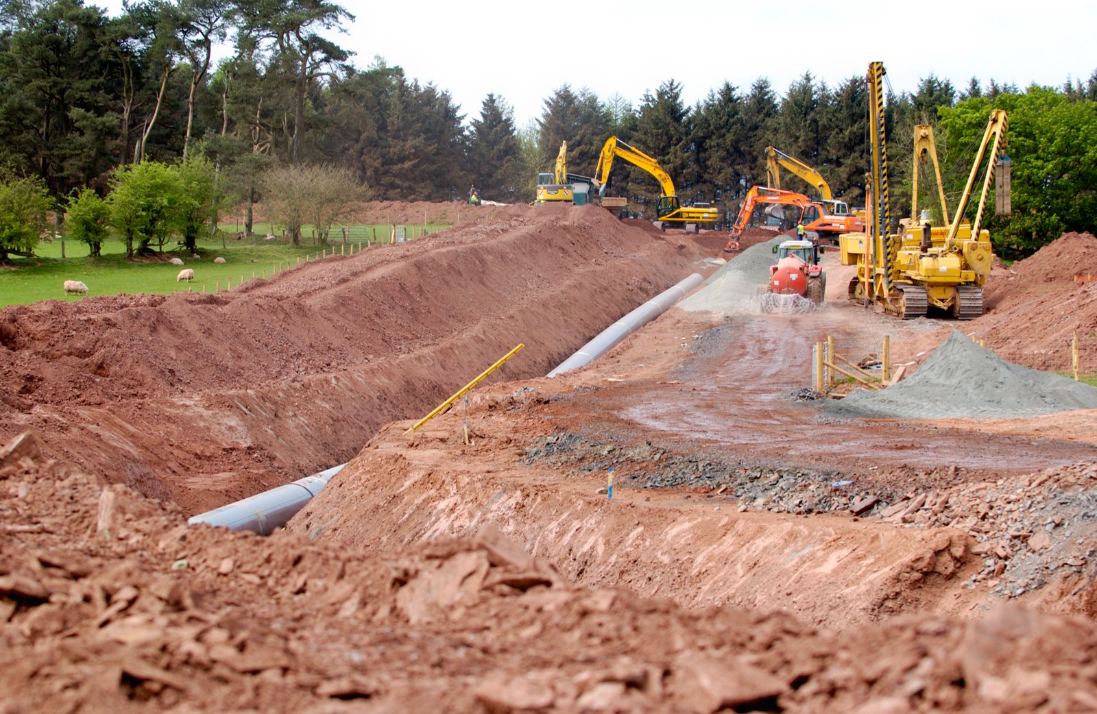
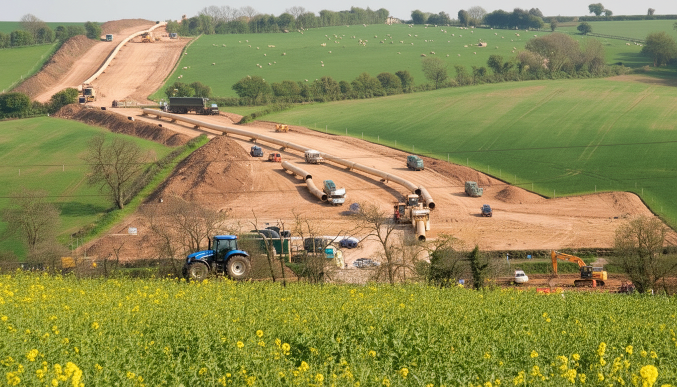
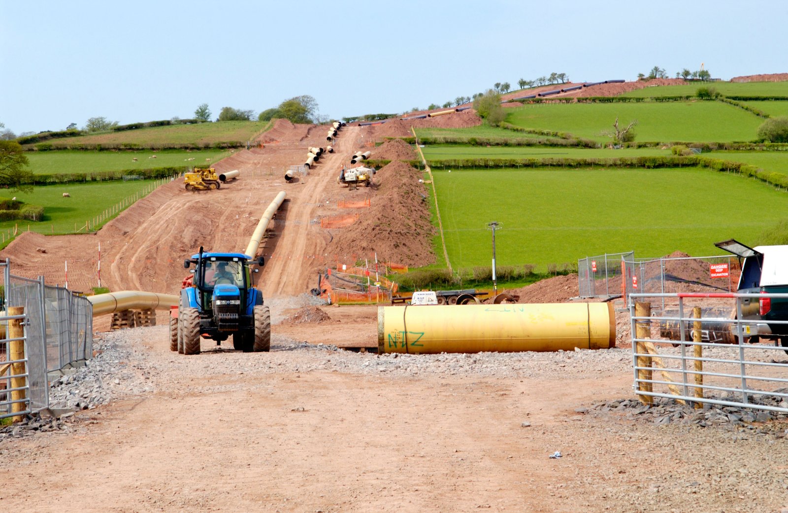
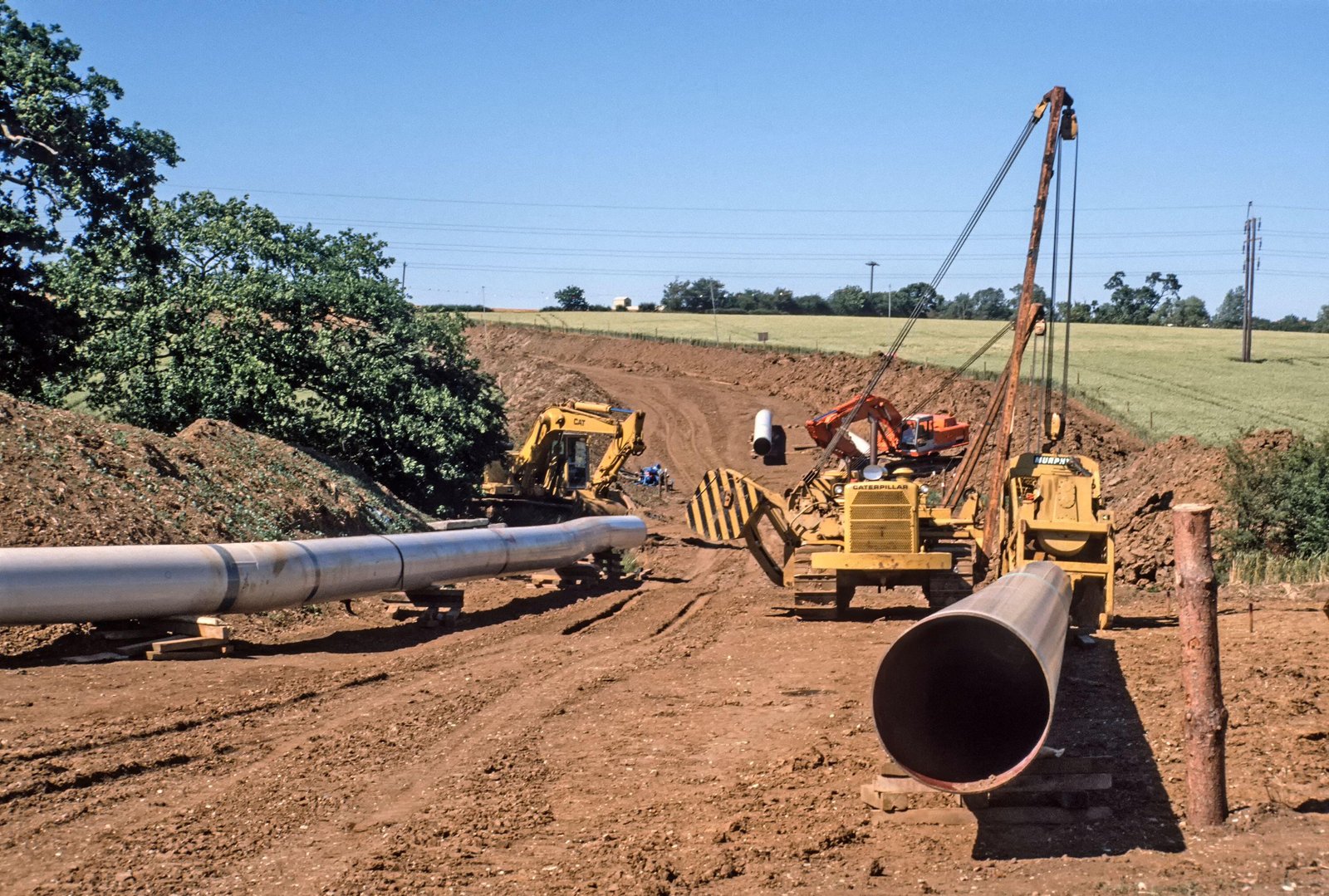
Copyright Notice: The 4 images above are copyright Alamy Ltd. A license has been purchased to allow these images to be used on this website but copying and reproduction is not permitted without the permission of Alamy Ltd.
I do not wish to go into a highly detailed examination of the construction process around Whaley Bridge here. I would however recommend that anyone with an interest in how the construction phase might impact them should spend ten minutes reading the Peak Cluster Environmental Impact Assessment – Scoping Report Volume 1, sections 3.2.67 to 3.2.93 (Pages 28 to 31). This gives a much clearer idea of what to expect. You can also review the Peak Cluster factsheet “AN OVERVIEW OF THE PIPELINE AND ITS PROPERTIES”.
While reading the above material in relation to the pipeline route around Whaley Bridge please keep in mind the landscape that this construction will be built on. It will cross moorland, woods, hills and farmland. It will also have to cross rivers, canals, roads and railways. Read the construction information in conjunction with the maps and videos etc. on the Route page of this website. Also remember that all this construction will require access roads to facilitate heavy transport and equipment, storage depots, car parking etc.
This facebook video was posted by AACCS (Action Against Carbon Capture and Storage). To clarify, the "highpeakpipeline.info" website is not part of, or associated with, AACCS.
Operations
Safety of the Pipeline
Clearly the safety of the pipeline is an important consideration. Peak Cluster offers significant reassurance the pipeline will be operated safely and state:
“Safety is our top priority. From design and construction through to operation, Peak Cluster is committed to the highest standards and we are fully confident that our pipeline will be delivered and operated safely.”
It needs to be emphasised that there are many thousands of miles of pipelines operating safely throughout the UK so it probably seems unnecessary to even consider safety once the pipeline is operating. There are however a number of potentially significant issues which need to be understood about the safety of the pipeline as it passes close to Whaley Bridge. I will try and focus on this aspect of safety although it is impossible to do so in any detail without reference to more general concerns about large CO₂ pipelines.
To start to understand some of the potential risks of CO₂ pipelines I would suggest the following reading which is detailed without becoming too complex.
CO₂ hazards in Carbon Capture, Utilisation, and Storage (CCUS)
This link (Author: Viktoria Bohacikova, Technical Product Specialist at Gexcon) provides an excellent overview of the many safety issues associated with CO₂ pipelines etc. Read the Gexcon article
The poster below gives an overview of the potential risks that might arise from any carbon dioxide pipeline crossing the Peak District.
Scroll left to right to view the entire poster.

Takeaways
In summary I make the following (personal) points based on the above research
- 1)There is a small, but not insignificant, risk of gas pipelines being damaged by landslips, geological events, or other causes.
- 2)Should a CO₂ pipeline be damaged or rupture in an area of hilly or complex terrain, the behaviour of any CO₂ gas released is not yet fully understood as the research into this is not yet concluded.
- 3)The proposed pipeline route arguably comes much too close to the highly populated area of Whaley Bridge (Population around 6,500) over quite a distance as it curves around the town.
- 4)The proposed pipeline as currently planned is running for quite a distance in terrain at an elevated height above Whaley Bridge. CO₂ is heavier than air and might flow down into the town and accumulate in low lying areas.
- 5)The emergency services response to such an incident is not yet clearly defined and is currently being researched as part of Project Skylark.
- 6)The consequences of a scenario where a CO₂ pipeline ruptures in hills above, but close to, a population centre (such as Whaley Bridge) are difficult to contemplate!