Impact area · Environment
Environmental
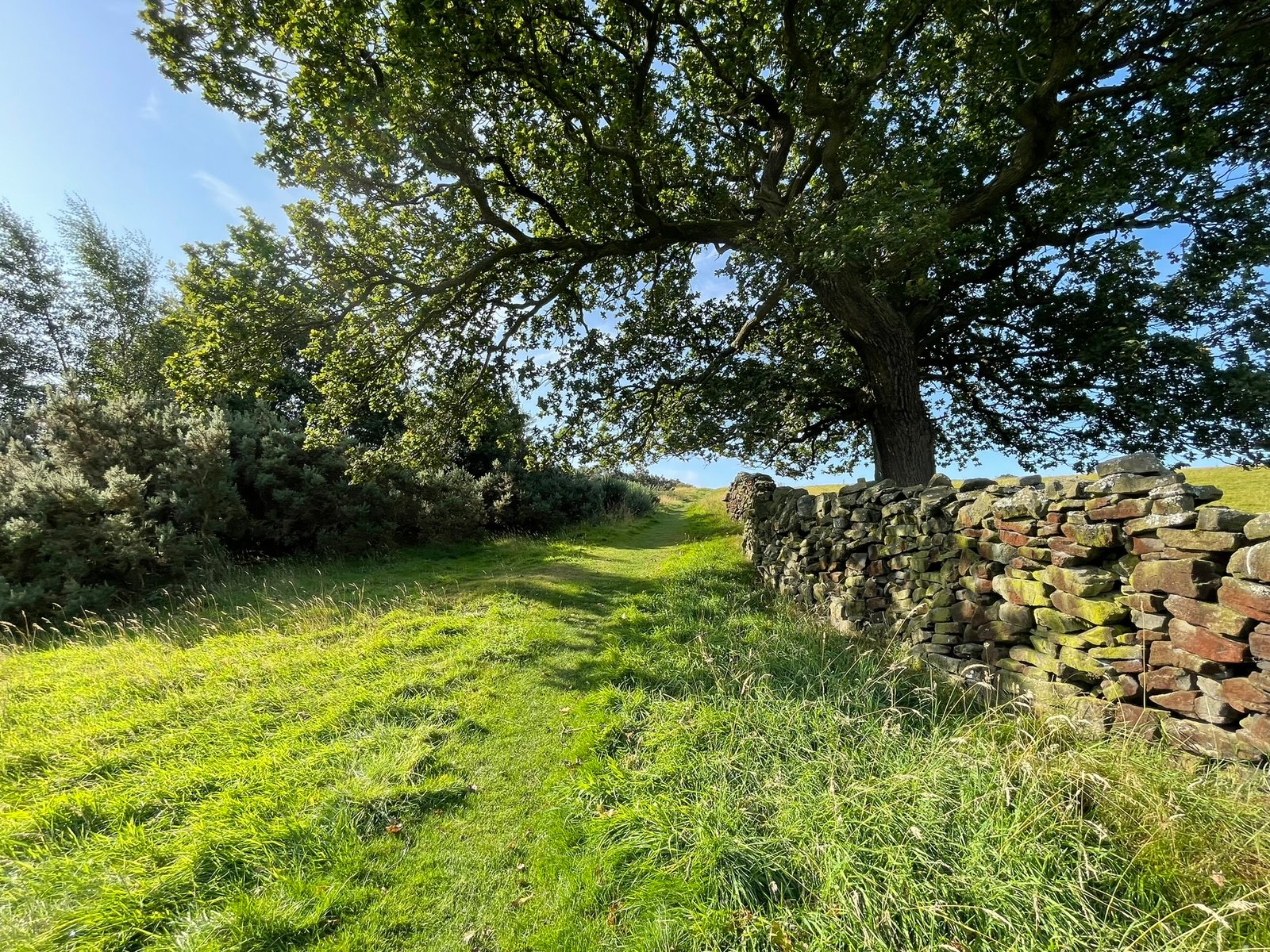
Environmental impact around Whaley Bridge.
The proposal
A Scar Across the Hills: The potential environmental cost of the Peak Cluster CO₂ pipeline around Whaley Bridge
There is an understandable irony at the heart of the Peak Cluster proposal. A project intended to reduce industrial carbon emissions might, during its construction, cause substantial and potentially long-lasting damage to one of Britain's most valued landscapes.
There is so much to say about the possible environmental cost of the Peak Cluster Pipeline around Whaley Bridge.
This section of the website will be under continuous development and input; photographs and personal knowledge of the areas potentially affected by the Peak Cluster project are very welcome.
Survey work
Ecology of the area
Over the spring and summer months of 2026, a local resident conducted rigorous, continuous botanical monitoring across some of the landscape that lies within the Peak Cluster pipeline scoping zone. The majority of their observations were logged and verified to Research Grade standard via iNaturalist. This ongoing work has revealed a complex, high-value four-part habitat mosaic directly within the proposed pipeline corridor footprint. Below is a detailed summary of this work.
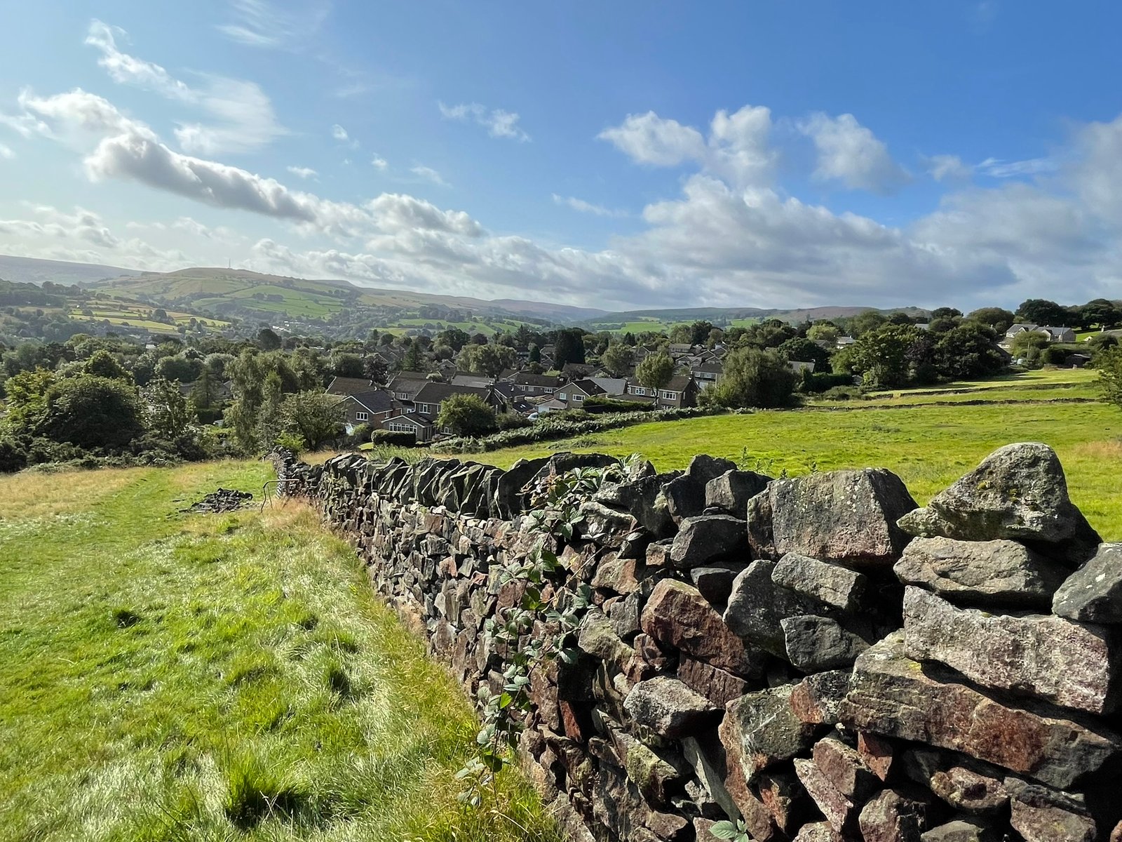
The free-draining slopes and ridges feature an intact, classic unimproved acid sward, while the poorly drained hollows support a wet pasture mosaic — together forming a connected system that the proposed working corridor would slice through.
1. Lowland Dry Acid Grassland (UK BAP Priority Habitat)
The free-draining slopes and ridges feature an intact, classic unimproved acid sward. Key indicator grasses include an abundance of Festuca rubra (Red Fescue), Deschampsia flexuosa (Wavy Hair-grass), Agrostis capillaris (Common Bent), and Anthoxanthum odoratum (Sweet Vernal-grass). This fine-grass matrix supports a highly specialized, low-nutrient flora; crucially, Rumex acetosella (Sheep's Sorrel) is widespread across the entire field matrix. Alongside our records of Conopodium majus (Pignut), Campanula rotundifolia (Harebell), Potentilla erecta (Tormentil), Galium saxatile (Heath Bedstraw), and Achillea millefolium (Yarrow), this indicates a classic, high-value NVC U1 acid grassland community.
This baseline is further enriched by widespread semi-parasitic Euphrasia species (Eyebrights), native clover species — predominantly Trifolium repens (White Clover) interspersed with sparser Trifolium pratense (Red Clover) — and Ranunculus species (Buttercups) throughout the field. Frequent Leontodon species (Hawkbit) provide a vital foraging source for native pollinators and bees. Localized patches of Vaccinium myrtillus (Bilberry) further demonstrate a seamless transition into a high-value heath-grassland mosaic. The extensive distribution of these low-pH specialists proves that this sensitive ecological profile is uniform across the site.
Furthermore, the ground layer forms a dense, continuous carpet of mosses beneath the sward. While I lack the specialist bryological expertise to log every distinct species, the volume of this layer is a major structural feature characteristic of undisturbed ground. It likely comprises acid-pasture specialists such as Rhytidiadelphus squarrosus (Spring Bouncy-moss), Pleurozium schreberi (Schreber's Big Red Stem Moss), and Polytrichum species (Haircap Mosses) on the slopes, transitioning to Sphagnum species in the flush zones.
2. Purple Moor-Grass and Rush Pasture (UK BAP Priority Habitat)
In the poorly drained depressions and flushing hollows, the habitat transitions into a wet pasture mosaic characterized by a specialized wetland flora, including Juncus conglomeratus (Compact Rush), Carex hirta (Hairy Sedge), Cardamine pratensis (Cuckooflower), Cirsium palustre (Marsh Thistle), and Lotus pedunculatus (Greater Bird's-foot-trefoil).
Crucially, this wet network functions as vital terrestrial foraging and overwintering habitat for a local amphibian population. This functional connectivity is supported by direct boundary evidence: a newly established garden pond immediately bordering the research area has already successfully recruited native newt species (Lissotriton/Triturus sp.), alongside regular records of Bufo bufo (Common Toad) — a UK BAP Priority Species. Because amphibians rely heavily on adjacent rough grassland and moss matrices for winter hibernation, any pipeline trenching or topsoil stripping in this zone poses a direct threat of mortality to these protected species, risks permanently severing a critical localized breeding-to-foraging migration corridor, and presents a severe hydrological drainage threat to the entire wetland system.
3. Successional Gorse & Mature Native Broadleaf Scrub Matrix
Extensive, mature thickets of Ulex europaeus (Common Gorse) form a complex structural canopy across the upper slopes. Crucially, this is an established woodland-edge matrix featuring mature trees, including Quercus (Oak), Sorbus aucuparia (Rowan), Ilex aquifolium (Holly), Fraxinus excelsior (Ash), Sambucus nigra (Elder), and Betula (Birch). This diverse canopy is tightly interwoven with climbing Lonicera periclymenum (Honeysuckle) and Rubus fruticosus (Blackberry).
Acoustic monitoring and local field observations have identified this dense structural mosaic as supporting a vital avian community. This includes the UK Red-listed / BAP Priority Linaria cannabina (Linnet), alongside an outstanding assemblage of Amber-listed / BAP Priority species: Chloris chloris (Greenfinch), Prunella modularis (Dunnock), and Turdus philomelos (Song Thrush), and the summer migrant Phylloscopus trochilus (Willow Warbler). The habitat also supports Fringilla coelebs (Chaffinch), Sylvia borin (Garden Warbler), Carduelis carduelis (Goldfinch), Turdus merula (Blackbird), Troglodytes troglodytes (Wren), and Erithacus rubecula (Robin). This multi-layered habitat forms the immediate, protective overhead shield for the active badger setts previously logged.
Aerial Foraging Infrastructure (UK Red/Amber-Listed Hirundines and Swifts)
Beyond the structural canopy, continuous summer evening observations have logged an outstanding aerial foraging assemblage actively hunting over the field matrix. This includes the UK Red-listed Apus apus (Swift) and Delichon urbicum (House Martin), alongside the Amber-listed Hirundo rustica (Swallow). The intense foraging activity of these declining aerial insectivores provides direct empirical proof of the high insect biomass generated by the undisturbed wet pasture and chemical-free sward below. This underscores the fact that the ecological destruction of this parcel will instantly sever a vital feeding ground that sustains these migratory species during their critical breeding window.
4. Riparian Clough Woodland Corridor
In one corner of the research area, a steep, shaded stream corridor (clough) handles natural flood and silt management for the slope. This features mature deciduous tree cover and specialized, humid micro-climates that support a classic woodland ground flora, characterized by a classic wet-woodland tall-herb flora, including verified records of Wild Angelica (Angelica sylvestris). Merlin acoustic data has also verified the presence of the canopy-dwelling summer migrant Phylloscopus collybita (Chiffchaff) actively utilizing this riparian woodland zone. This habitat is highly vulnerable to upslope construction runoff and siltation.
Landscape-Scale Context: Connectivity and Survey Access
While my survey efforts are focused heavily on this specific area — due to the multiple footpaths allowing comprehensive, non-intrusive access — I have noted from parallel public rights of way that the adjacent fields along this pipeline corridor display identical ecological indicators. I have observed widespread Sheep's Sorrel, identical acid grass matrices, Marsh Thistle flushes, and matching Gorse thickets directly continuous with this site. This indicates that this is not an isolated pocket, but part of a wider, continuous, and highly sensitive landscape-scale ecological corridor that the current pipeline routing threatens to slice completely in half.
Future Survey Intentions & Conservation Objectives: CHEGD Assemblage
Given that my preliminary walkovers have already yielded six distinct varieties of waxcap (Hygrocybe s.l.) on a single, casual inspection, the site has already crossed the threshold for Regional Ecological Significance for grassland fungi.
Consequently, I have formed a community group and we are actively preparing a comprehensive, structured autumn mycological monitoring program between October and November to fully map the CHEGD assemblage (Waxcaps, Pinkgills, Fairy Clubs, and Earthtongues) across the uniform NVC U1 turf. Because fungi fruit highly unpredictably based on seasonal flushes, there is a high statistical probability that this undisturbed soil profile supports a community of National Significance (9+ species).
We strongly state our intention to protect this subterranean mycelial network from any compaction or topsoil stripping, and we expect any upcoming Environmental Statement to defer to a comprehensive autumn fungal survey before any planning decisions are made.
Summary of Requests for Action
We seek the wider community's urgent support in demanding the following actions from the Examining Authority and Peak Cluster Ltd:
- A) Mosaic Evaluation: That the pipeline's impact is evaluated as a complex, interlocking habitat mosaic rather than an isolated pasture.
- B) Phase 2 Boundary Mapping: That the upcoming Phase 2 ecological surveys explicitly and accurately map these individual UKHab priority boundaries on the ground.
- C) Specialist Bryologist Inclusion: That a qualified bryologist is formally included in Peak Cluster's upcoming Phase 2 team to map the extensive lower-plant moss community, which acts as a critical indicator of long-term soil stability and ancient pasture continuity.
- D) Landscape Corridor Assessment: That Peak Cluster's ecologists be required to evaluate the wider connectivity of the adjacent fields, recognizing that the environmental destruction will echo far beyond our field boundaries.
- E) Seasonal Fungal Deferral: That no localized route alignment choices are locked in until a full, compliant autumn macrofungal survey has been executed during the peak October–November fruiting window.
Heritage
History and Archaeology
Whaley Bridge and its surrounding area are rich in History and Archaeology. Much of this is so tightly integrated into the area that it can be difficult to identify its importance on a local, national and international level.
Landscape features and structures may be so familiar to local residents that their importance may be missed. These must not, however, be ignored when considering the effect that a major construction project might have on the rich local history of this area.
In no particular order we will list below some of the archaeology and history that covers the landscape and attempt to emphasise its significance. Hopefully you may be able to add to this with your own family histories or personal research. If so, please contact us below!
Heritage feature
Drystone Walls
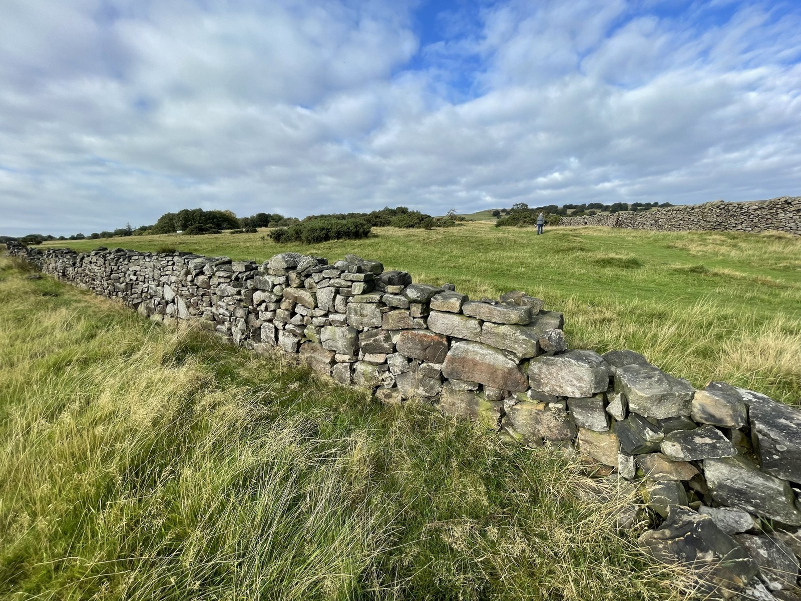
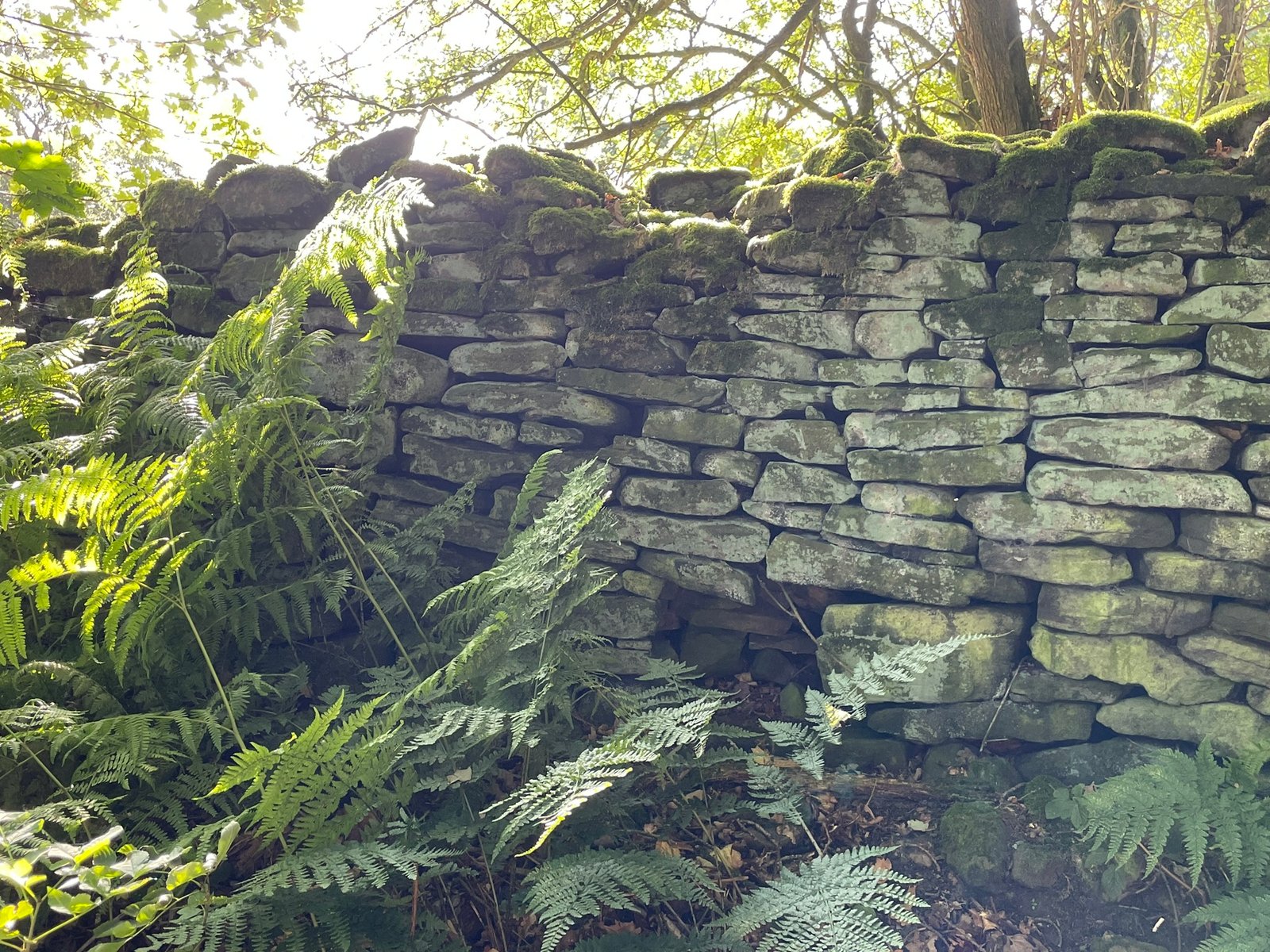
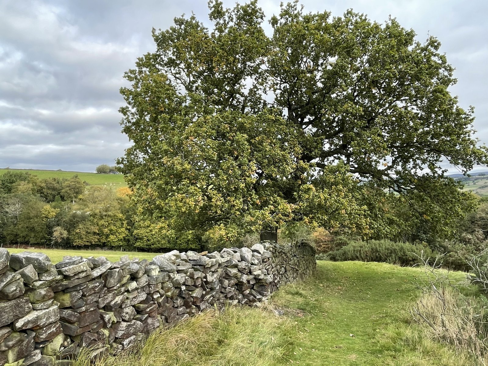
It may seem odd to start this section with a feature that is so common around us that, to many of us, it has become almost invisible. The common dry-stone wall can, however, be a significant part of local history going back hundreds of years.
Dry-stone walls are one of the most distinctive features of the Peak District landscape. Stretching across limestone plateaux, gritstone uplands and enclosed valleys, they are more than simply agricultural boundaries: collectively they record centuries of farming, land ownership and changing patterns of settlement. A 1991 survey estimated that the Peak District National Park contained around 8,756 km of dry-stone walls and banks, demonstrating just how extensively walling has shaped the landscape.
The tradition is considerably older than many of the walls visible today. Dating individual walls is difficult because they have repeatedly been repaired and rebuilt, but some boundaries are thought to have medieval origins, while archaeological evidence suggests that later walls sometimes follow much older boundaries, including Romano-British features. Medieval communities generally farmed parts of the Peak District through systems of open fields, strips and common grazing. As these systems gradually changed, walls increasingly divided land into individual holdings and livestock enclosures.
The greatest period of dry-stone wall construction, however, came much later. From the 17th century onwards, and especially during the 18th and early 19th centuries, large areas of common land were enclosed. Parliamentary Enclosure Acts accelerated this process, creating the characteristic networks of long, straight walls and relatively regular fields that can still be seen across parts of the Peak District. The National Park Authority estimates that although some boundaries are much older, most of the field patterns visible today were created roughly 150–250 years ago.
Today, Peak District dry-stone walls are valued not only as functional farm boundaries but as an important part of the area's cultural landscape and historic character. Their irregular ancient enclosures, fossilised medieval field systems and ruler-straight Parliamentary Enclosure walls allow the history of farming to be read directly in the landscape. Consequently, removing and rebuilding a wall is not always equivalent to replacing an ordinary fence: in some locations the wall, its alignment and its relationship with surrounding fields may form part of a landscape pattern that has developed over several centuries.
Further watching
If Walls Could Talk
The video below by Roland Keates provides a fascinating insight into many aspects of dry-stone walling in the Peak District, including its historical significance. Visit his website Lost Histories.
Based on the current Peak Cluster search corridors, the density of dry-stone walls in the Peak District and the project's proposed 30–40 m construction working width, it is probably reasonable to estimate several kilometres of existing dry-stone wall to require dismantling and reconstruction along the pipeline route — perhaps 0.5–1.2 km in the immediate Whaley Bridge area. The final quantity cannot be established until Peak Cluster publishes its refined route and construction limits.
Heritage feature
Plantation rings, Clumps, or Shelterbelts
For many of us, Plantation rings, Clumps, or Shelterbelts are another feature that we miss in our local landscape. The area round Whaley Bridge and in significant parts of the pipeline scoping zone is, however, rich in these historic features. Although they may seem just a typical part of the landscape, these features are becoming increasingly rare on a national level and deserve significant protection.
Plantation rings in particular are often planted directly over prehistoric monuments. The best known example is Minninglow. Located in the White Peak area just off the High Peak Trail, its summit features an unmistakable circular crown of mature beech trees enclosed by a dry-stone wall. This tree-fringed hill is a burial chamber dating from the Neolithic and Bronze Age.
As far as we can determine, none of the plantation rings around Whaley Bridge — of which there are a few within the pipeline scoping zone — have ever been investigated for their archaeological significance.
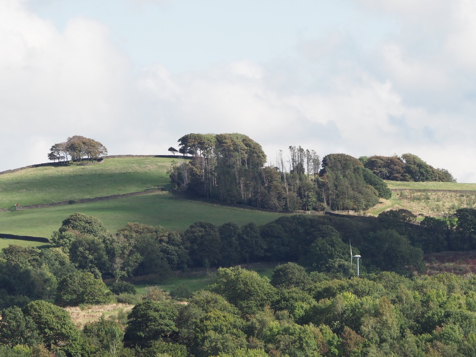
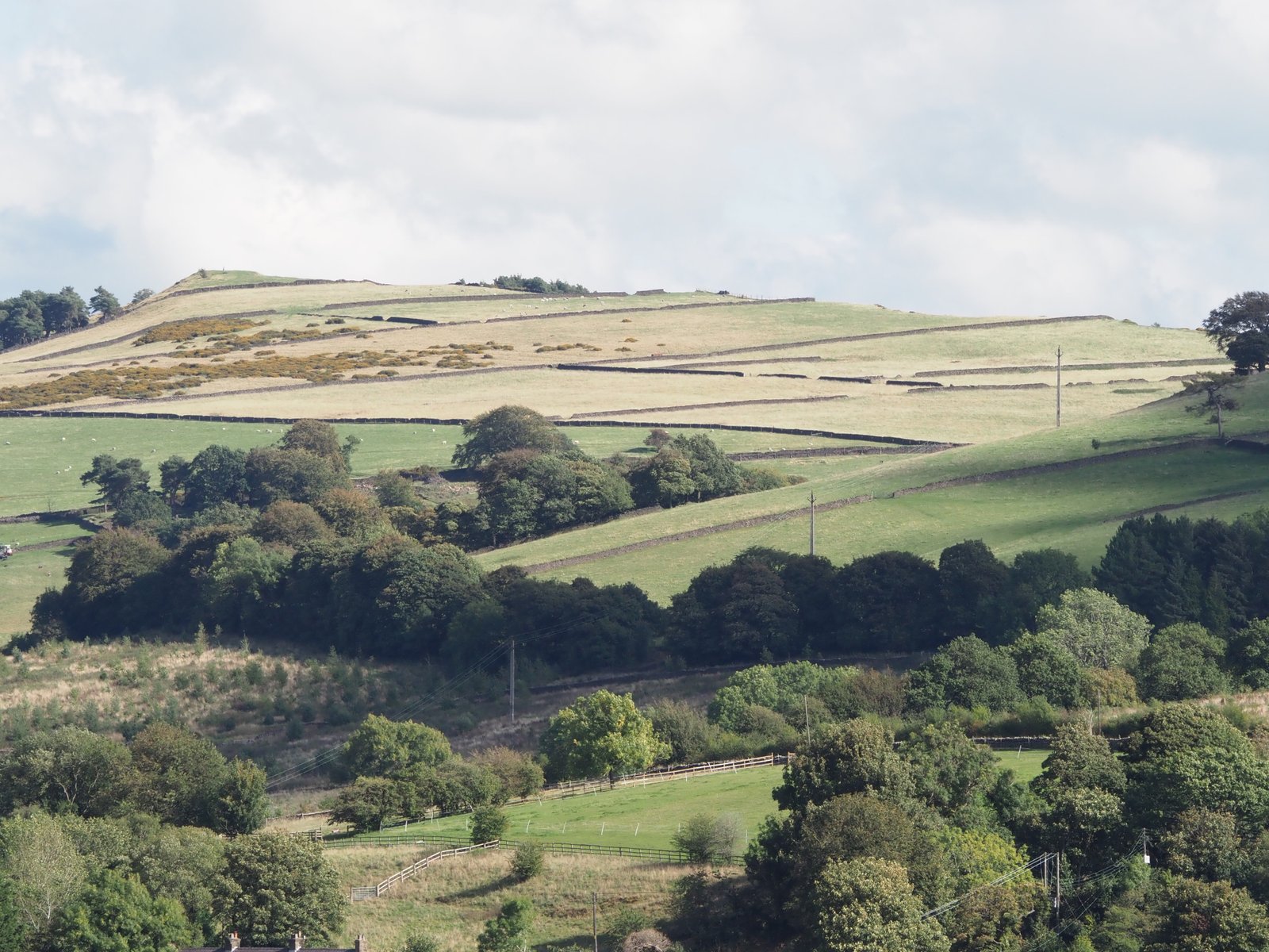
Plantation Rings (Beech Rings / Hilltop Clumps): These are prominent, circular arrangements of trees planted on hilltops, ridges, or tumuli (ancient burial mounds). Originally planted by wealthy landowners during the Georgian and Victorian eras, they were designed as aesthetic focal points in the landscape, to denote land ownership boundaries, or to highlight archaeological features.
Clumps: Small, isolated groups of tightly grouped trees (often Scots pine, beech, or sycamore) scattered across open grazing pastures. They provide focal visual points and localized shade for livestock.
Shelterbelts: Linear, multi-row strips of trees and shrubs designed to break the force of the punishing upland winds. Historically planted next to traditional gritstone farmsteads and exposed agricultural fields, they protect crops, structures, and livestock from soil erosion and severe weather.
Heritage feature
Industrial archaeology and mineworkings
Whaley Bridge is, in many respects, a town created by industry. Its position beside the River Goyt, close to outcropping coal seams and at a natural crossing of the Pennines, made it an important meeting place for mines, mills, canals and railways.
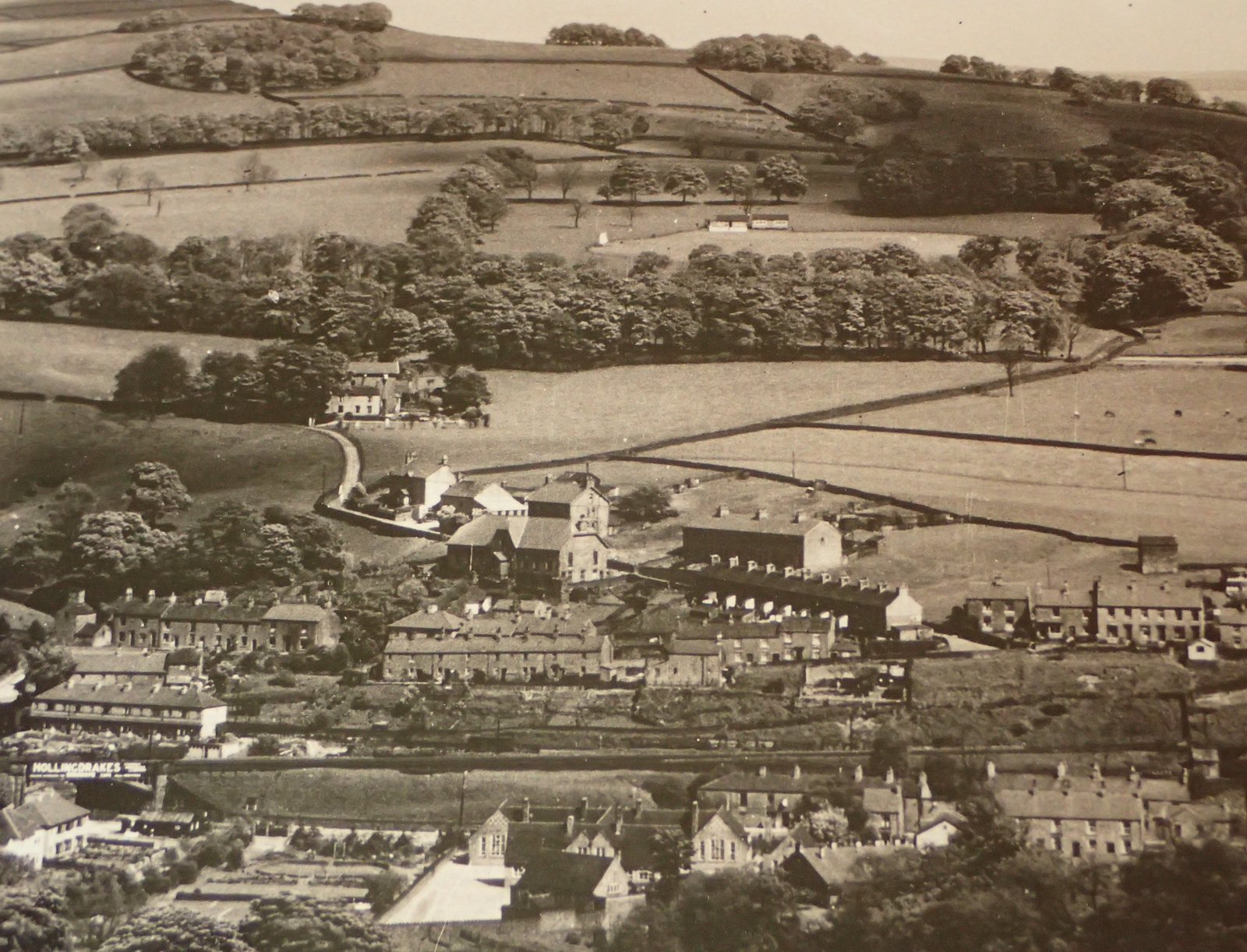
Whaley Bridge circa 1920. Evidence of old mine workings in the town. Ring Plantations and shelterbelts described in the above section clearly visible on the slopes of Browne Hill above the town.
Coal was being worked locally by at least 1587, and probably much earlier. A geological fault running through the Whaley Bridge basin brought seams close to the surface, encouraging numerous small pits, shafts and adits. The largest concern was Waterloo Pit, opened in 1815 and later known as Whaley Bridge Colliery.
Most surface structures have disappeared beneath later development, but a striking sandstone ventilation-shaft tower survives beside Bings Road. Associated with Waterloo Colliery and a shaft said to have been about 400 feet deep, it is now a rare visible reminder of the workings beneath the town. Other pits operated around Shallcross, Horwich End and Furness Clough, leaving less obvious traces such as spoil heaps, disturbed ground, old trackways and mine-drainage channels. Derbyshire Historic Environment Record
The arrival of the Peak Forest Canal transformed the district. Authorised in 1794 and opened around the turn of the nineteenth century, it provided an outlet towards Manchester for limestone, lime, coal, cotton and manufactured goods. At Whaley Bridge Basin, the Grade II*-listed transhipment warehouse stands across the head of the canal. Its openings allowed boats and railway wagons to enter the building so that cargo could be transferred under cover. Nearby Buxworth Basin, formerly Bugsworth, developed into a vast interchange of wharves, tramways and limekilns. Canal & River Trust
In 1831 the Cromford and High Peak Railway linked Whaley Bridge with the Cromford Canal. Initially horse-worked, it crossed the hills by steep, rope-worked inclines. The Shallcross Incline rising from the canal basin is one of the clearest surviving local features; remains include its engineered track bed and chain guides. The line closed as a through railway in 1967, when freight transferred to the valley's older railway, although the upper incline continued carrying coal until 1952. Whaley Bridge Town Council
Industry was not confined to extraction and transport. Water from the Goyt and its tributaries powered cotton spinning, bleaching and calico printing. Botany Works began as a bleaching concern in 1830, while Goyt Mill and Bingswood Printworks formed part of a wider textile landscape of mill buildings, mill ponds, leats, workers' housing and railway sidings. By 1871 textiles had overtaken mining and agriculture as the town's principal employer. Derbyshire Record Office
Much of Whaley Bridge's industrial archaeology is therefore hidden in plain sight. The canal basin, warehouse, railway bridges and inclines are conspicuous monuments, but garden walls, terraces, culverts and uneven patches of ground also preserve the pattern of former collieries and factories. Together they reveal a closely connected industrial system in which local coal powered mills and lime-burning, reservoirs supplied canals and works, and successive generations of tramway, canal and railway carried materials through the High Peak.
Photo gallery
Gallery
A selection of photographs of the landscape around Whaley Bridge and the wider Peak Cluster pipeline scoping zone. More photographs will be added over time.