Impact area · The route
The proposed route
This page focuses on the route of the pipeline as it passes around Whaley Bridge. The actual route is not yet defined but it is currently proposed that it will lie within a "Scoping Zone" shown on the map below.
The line
Pipeline route map
The pipeline would carry captured CO₂ from the cement and lime works of the Peak District to storage beneath the Irish Sea.
The route information from Peak Cluster Ltd was updated on 21st September 2026. The new map below illustrates the new route around Whaley Bridge.
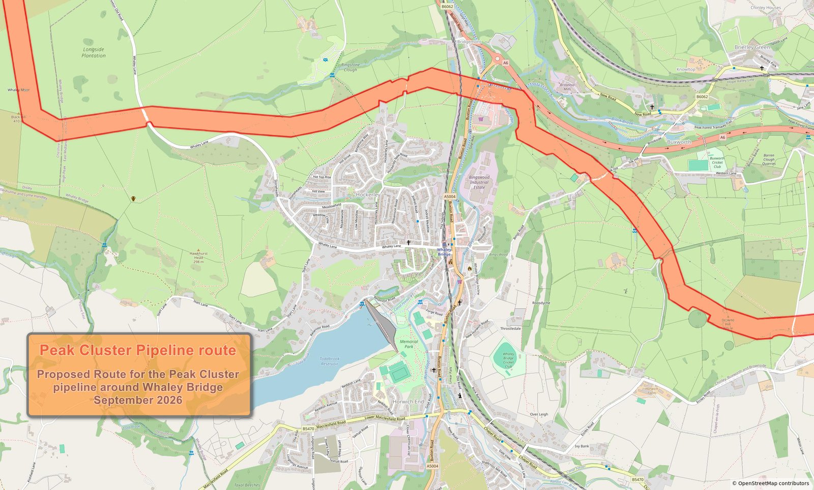
For details of the entire route you can View the Peak Cluster interactive map
See the route
A short film about the proposed route
A video walkthrough of the corridor and the country it would cross helps make the scale of the project tangible.
Along the route
Panoramas of the corridor
These wide panoramas show the landscape the pipeline would pass through. Scroll each image horizontally to take in the full view. Panorama updated to take account of new reoute information published 21st September 2026

